Texas State Archives Map Collection
San Jacinto County
| Date: | 1889 |
| Publisher: | General Land Office, May 1889. Traced September 1914 by O.O. Terrell |
| Cartographer: |
Blau, F.G. |
| Scale: | 7/8 inch = 5000 varas |
| Size: | 38 cm x 30 cm |
| Type of Map: | survey |
| Format: | blueline |
| Language: | English |
| AC Number: | 04730 |
| Photo Media: | -- None Listed -- |
| File Size: | 3.43 MB |
San Jacinto County Image:
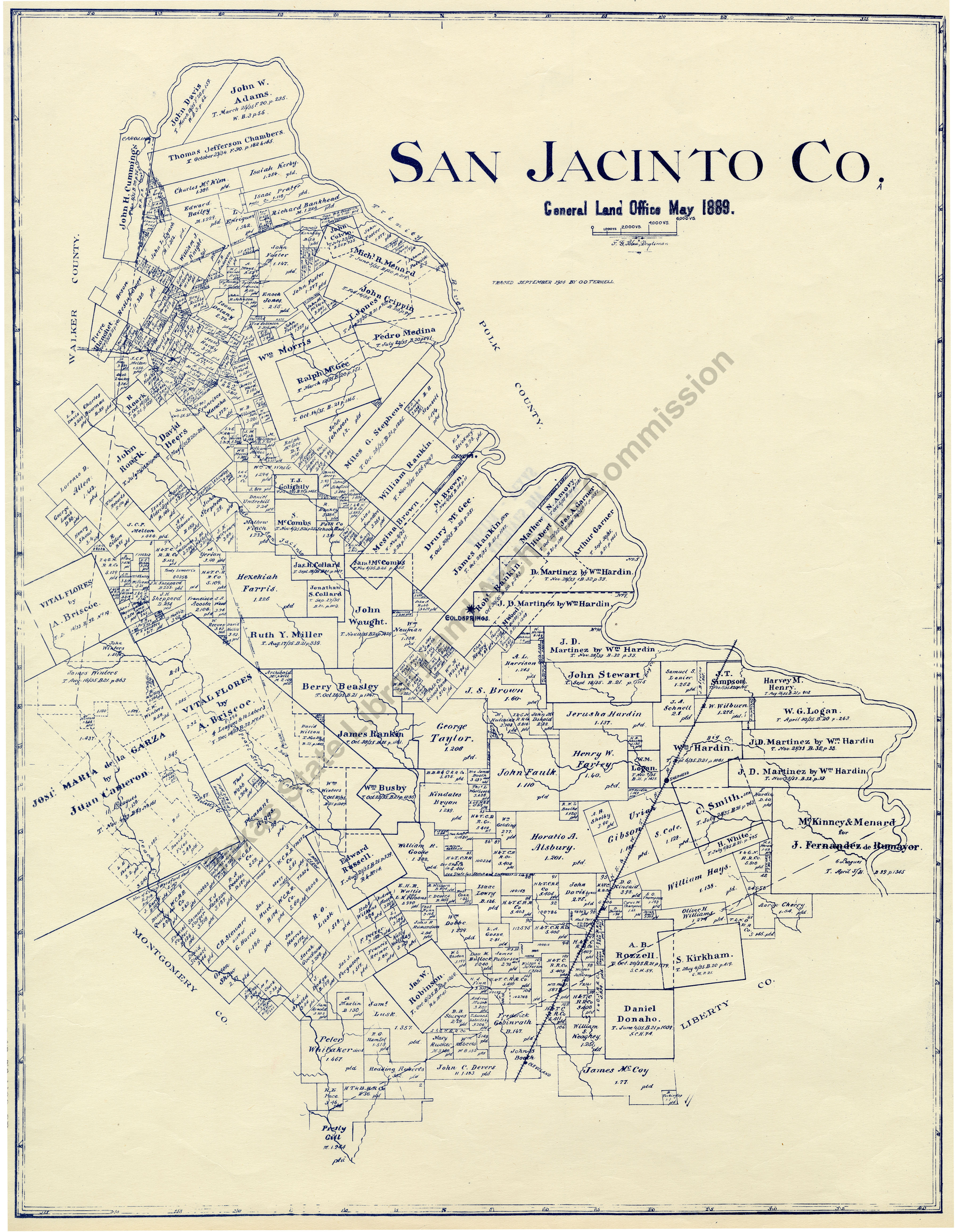
Description:
Shows rivers, creeks, original land grants or surveys, cities, towns, and railroads.
Published in Maps of All Texas Counties, (Tulsa: Wolf and Bennett, c/o American Royalty Petroleum Company).
8/5/85
Subjects:
The Texas State Archives Map Collection contains original, photo-reproduced, and compiled maps covering the period from the early seventeenth through the late twentieth centuries. For general information about the holdings and descriptive information available, read the map introduction and indexes and types of maps webpages. For our copy policy, view our webpage on preservation, access, and reproductions.
For information on additional maps in our holdings, read Maps in Other TSLAC Collections.