Texas State Archives Map Collection
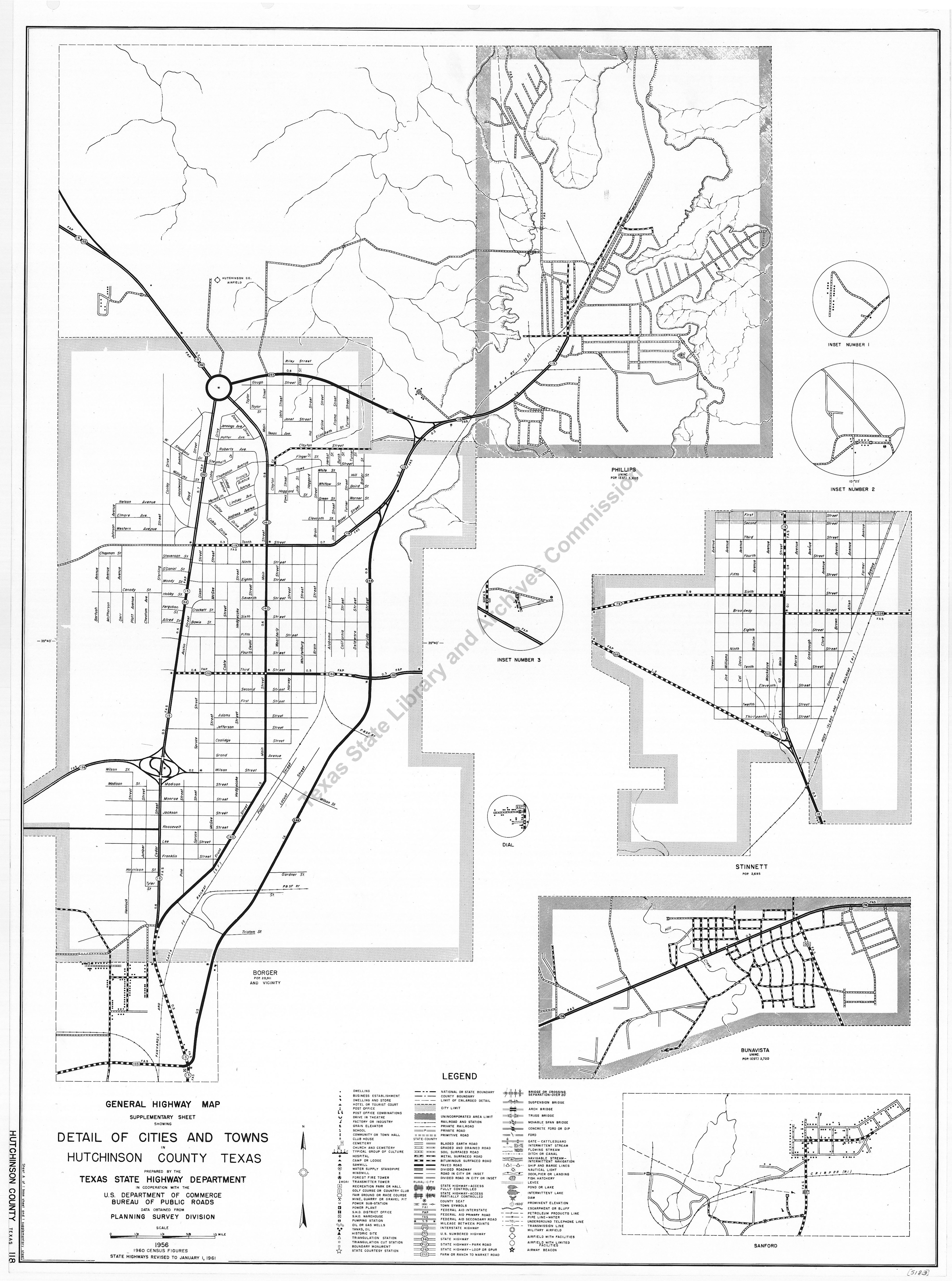
General Highway Map. Detail of Cities and Towns in Hutchinson County, Texas Borger, Stinnett and vicinity
| Date: | 1961 |
| Publisher: | Texas State Highway Department, in cooperation with the U.S. Department of Commerce, Bureau of Public Roads, 1956. State highways revised to January 1, 1961. |
| Cartographer: | -- None Listed -- |
| Scale: | -- None Listed -- |
| Size: | 61 cm x 45 cm |
| Type of Map: | street |
| Format: | black & white, engraved, lithographed, printed |
| Language: | English |
| AC Number: | 05183 |
| Photo Media: | -- None Listed -- |
| File Size: | 4.22 MB |
General Highway Map. Detail of Cities and Towns in Hutchinson County, Texas Borger, Stinnett and vicinity Image:
Description:
These are insets from map 5182. Shows rivers, lakes, creeks, streets, roads, highways (giving mileage between points), bridges, outlying buildings, post offices, schools, churches, railroads, and airfields. Insets: Phillips, Dial, Bunavista, Sanford, inset 3 - [intersection of FM 280 and state highway 152], inset 2 - [settlement along Cottonwood Creek]. inset 1 - [settlement along FM 2277. Later editions are 5525, 5916.
11/27/85
The Texas State Archives Map Collection contains original, photo-reproduced, and compiled maps covering the period from the early seventeenth through the late twentieth centuries. For general information about the holdings and descriptive information available, read the map introduction and indexes and types of maps webpages. For our copy policy, view our webpage on preservation, access, and reproductions.
For information on additional maps in our holdings, read Maps in Other TSLAC Collections.