Texas State Archives Map Collection
Athens City Map
| Date: | 1990 c. |
| Publisher: | Issued by the Athens Chamber of Commerce. |
| Cartographer: | -- None Listed -- |
| Scale: | none given |
| Size: | 36 cm x 37 cm |
| Type of Map: | street |
| Format: | color, engraved, lithographed, printed |
| Language: | English |
| AC Number: | 07708 |
| Photo Media: | -- None Listed -- |
| File Size: | 5.17 MB |
Athens City Map Image:
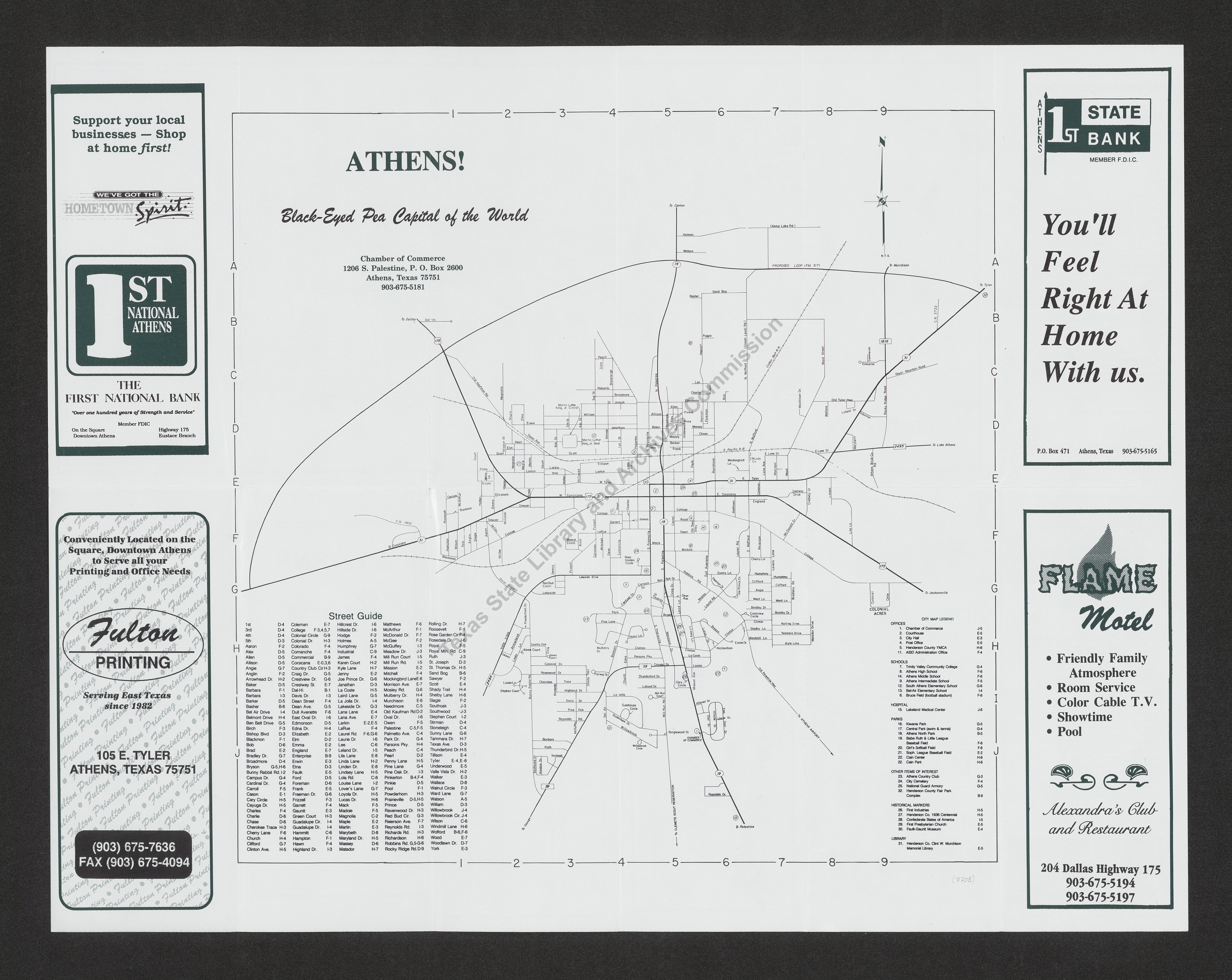
Description:
Shows streets, highways, railroads, public buildings, schools, cemeteries, historical markers, and other points of interest. A street index and advertisements are also present. Reverse side contains a map of Henderson County, general information about Athens and Henderson County, and advertisements.
7/16/98 (JW)
Subjects:
The Texas State Archives Map Collection contains original, photo-reproduced, and compiled maps covering the period from the early seventeenth through the late twentieth centuries. For general information about the holdings and descriptive information available, read the map introduction and indexes and types of maps webpages. For our copy policy, view our webpage on preservation, access, and reproductions.
For information on additional maps in our holdings, read Maps in Other TSLAC Collections.