Texas State Archives Map Collection
Texas and Her Eastern Boundaries
| Date: | 1866 |
| Publisher: | Department of the Interior, U.S. Geological Survey, October 2, 1866. |
| Cartographer: | -- None Listed -- |
| Scale: | none given |
| Size: | 40 cm x 52 cm |
| Type of Map: | other |
| Format: | color, tracing |
| Language: | English |
| AC Number: | 02814 |
| Photo Media: | -- None Listed -- |
| File Size: | 7.47 MB |
Texas and Her Eastern Boundaries Image:
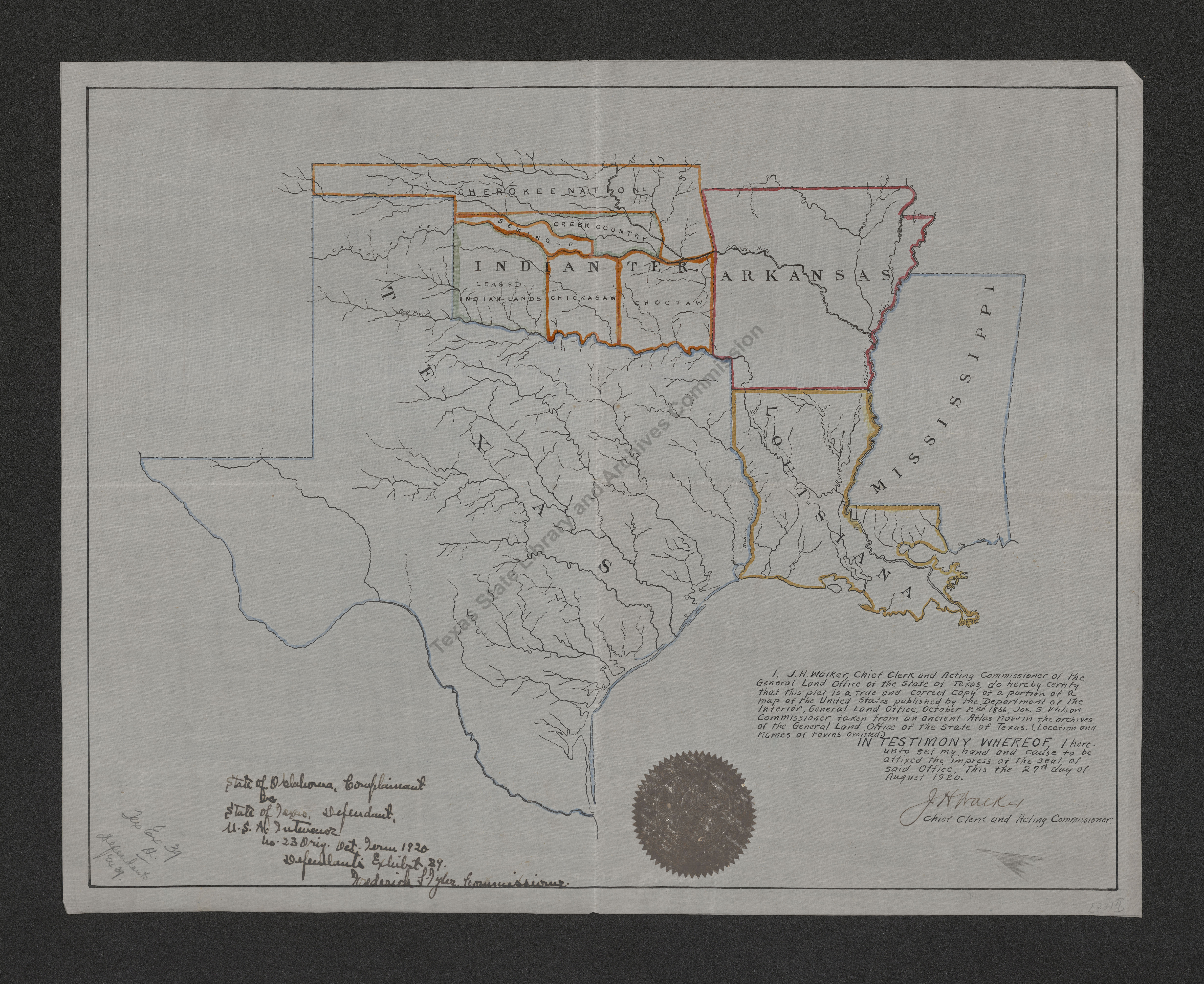
Description:
Tracing of part of a map of the United States, covering Texas, the Indian Territory, Arkansas, Louisiana, and Mississippi. Rivers are outlined, with major ones named, and Indian tribes are shown in the Indian Territory.
This map is part of the Oklahoma vs. Texas Boundary Dispute Records, Attorney General, RG 302, defendent's exhibit 29. Further materials may be found in the finding aid.
11/9/83
The Texas State Archives Map Collection contains original, photo-reproduced, and compiled maps covering the period from the early seventeenth through the late twentieth centuries. For general information about the holdings and descriptive information available, read the map introduction and indexes and types of maps webpages. For our copy policy, view our webpage on preservation, access, and reproductions.
For information on additional maps in our holdings, read Maps in Other TSLAC Collections.