Texas State Archives Map Collection
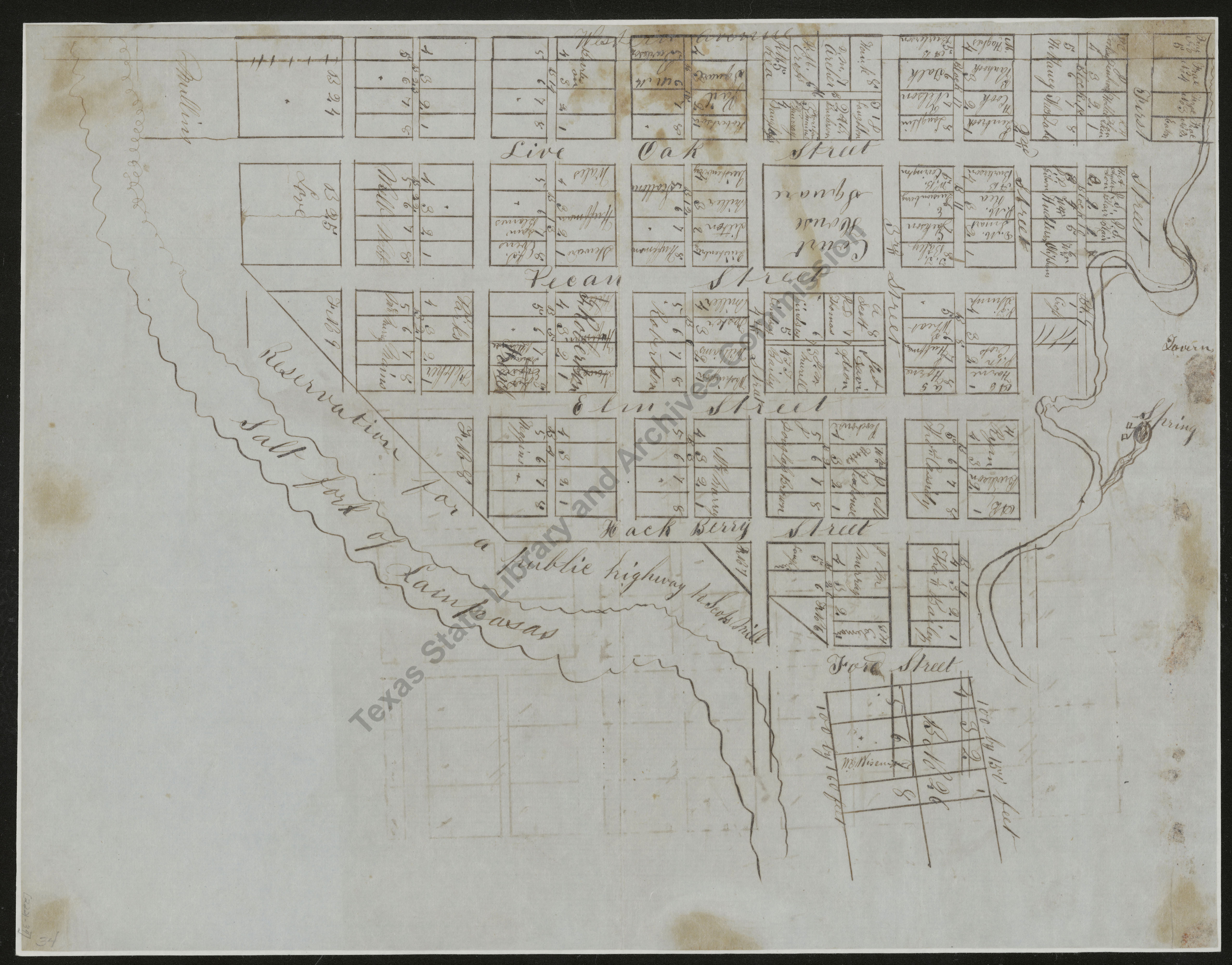
Map of Meridian, Bosque County
| Date: | 1850 c. |
| Publisher: | -- None Listed -- |
| Cartographer: | -- None Listed -- |
| Scale: | none given |
| Size: | 30 cm x 19 cm |
| Type of Map: | plat |
| Format: | black & white, manuscript |
| Language: | English |
| AC Number: | 02221-3 |
| Photo Media: | -- None Listed -- |
 View Image
 Download Image

 View Image
 Download Image

 View Image
 Download Image

 View Image
 Download Image

 View Image
 Download Image

 View Image
 Download Image

 View Image
 Download Image

 View Image
 Download Image

 View Image
 Download Image

 View Image
 Download Image

Other Related Maps and Images:
| Date | Map Number | Title | Image |
|---|---|---|---|
| 1850 c. | 02221-30 | Map of the City of Sabine |
view

|
| 1850 c. | 02221-31 | Town of Beaumont in Jefferson County, Texas |
view

|
| 1850 c. | 02221-32 | Plat of Kaufman, Kaufman County |
view

|
| 1850 c. | 02221-33 | Plan of Kerrville |
view

|
| 1850 c. | 02221-36 | Plat of the Town of Paris, Lamar County, Texas |
view

|
| 1850 c. | 02221-37 | Map of Centreville |
view

|
| 1850 c. | 02221-38 | Waco Village, County Seat of McLennan County |
view

|
| 1850 c. | 02221-39 | Town of Mason |
view

|
| 1855 c. | 02221-34 | Plat of Lampasas |
view

|
| 1855 c. | 02221-35 | Plat of Lampasas, Division A |
view

|
The Texas State Archives Map Collection contains original, photo-reproduced, and compiled maps covering the period from the early seventeenth through the late twentieth centuries. For general information about the holdings and descriptive information available, read the map introduction and indexes and types of maps webpages. For our copy policy, view our webpage on preservation, access, and reproductions.
For information on additional maps in our holdings, read Maps in Other TSLAC Collections.